Drone Services
Drone Panora™ provides Aerial Photography & Aerial Video services and flourishes on aerial photographic footage that captures visuals from a 360° panoramic perspective. We offer a wide range of cost-effective aerial photographic & video services that enable our customers to obtain aerial footage that is significantly cheaper than many other traditional methods.
Our number one priority is always SAFETY. Proficient pilots and camera operators fly our Drones. Flight technology includes live video, GPS, and fail-safe safety features. » See some of the well-known companies that trust us with capturing their Aerial Photography
If you need a Building Facade Inspection, look no further than the company that has done this on Sales Force Tower, the tallest building in San Francisco.
Building Facade Inspection
Drone Aerial Photography Specialists
Regardless of your needs, we can help you capture the aerial photographs and video you need.
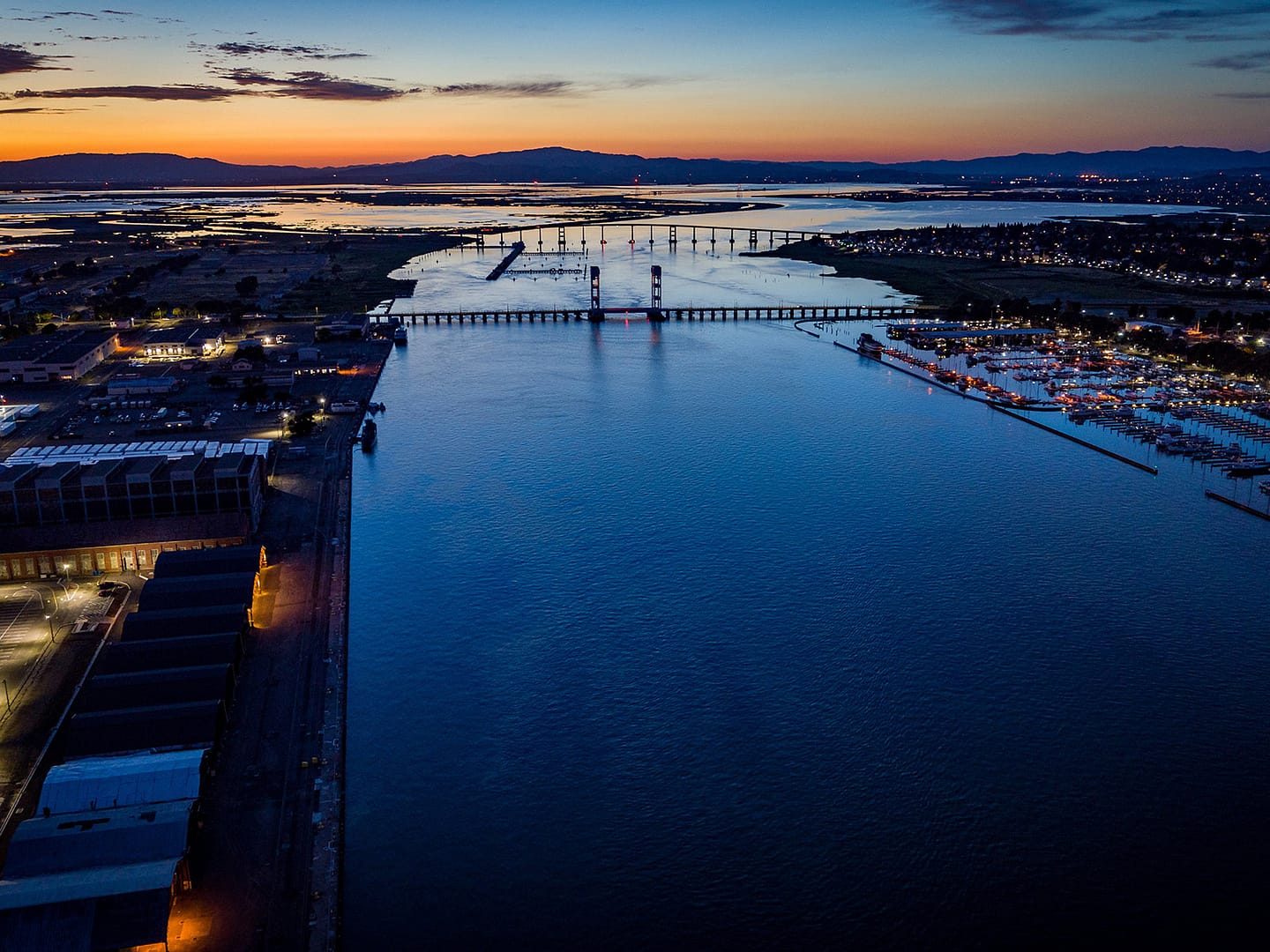
Area Surveys & Mapping
Disasters / Emergencies / Insurance / Crops / Property Views / Photogrammetry / Mapping | Surveying | Engineering
Accuracy and Faster Results
Aerial Surveying & Mapping services help speed up and lower the cost of land surveying and mapping services with a high level of precision and accuracy.
Inspections
Building Facade Inspection / Wind Turbine / Solar Imaging / Thermal Infrared Imaging/ Building / Roof / Gutter / Line and Tower Inspection / Insurance Claims
Informed Decisions Quickly!
Getting a bird’s eye view through Aerial Photography can be crucial to making informed decisions quickly. Whether you are assessing the damage, deploying resources, evaluating the environment, or illustrating where things are, an area survey from a drone can quickly provide this critical information with accurate, high-resolution topographic mapping & photogrammetry
Architectual
Photography
Real Estate Marketing / Architectural Survey / Advertising / Campaigns / Social Media
Sell it better!
Commercial Real Estate and Residential Real Estate Aerial Photography and Video Services in a variety of packages or customized options.
Area Surveys & Mapping
Disasters / Emergencies / Insurance / Crops / Property Views / Photogrammetry / Mapping | Surveying | Engineering
Getting a bird’s eye view through Aerial Photography can be crucial to making informed decisions quickly. Whether you are assessing the damage, deploying resources, evaluating the environment, or illustrating where things are, an area survey from a drone can quickly provide this critical information with accurate, high-resolution topographic mapping & photogrammetry.
Contruction
Site Observation / Progress Reviews
Construction projects typically last long periods and can often be challenging to see the full picture if they span large areas or distances. Drone-recorded aerial photos and video & can provide critical panoramic 360-degree views from many angles that contribute to an overall perspective of the construction site and the progress being made. It can also present critical documentation and photographic evidence that serves as proof of activities that were performed.
Events
Concerts / Weddings / Sports tournaments / Product launches / Award ceremonies / Parties / Charity functions / Company meetings / Press conferences / VIP events
Obtaining panoramic 360-degree views of your event can be a great way to capture breathtaking aerial video & photographic material of those special moments. You get to capture and record the event from a unique perspective.
Media
News/Information, TV, Film footage
Whether it’s gathering video or photos for the news or shooting footage for TV & Film, aerial panoramic area views provide unique perspectives that can tell and enhance the story. Traditional methods such as helicopters, planes, and cranes often take too long to arrange & set up and come with an expensive price tag. Drone aerial video & photo footage can be captured in a fraction of the time and at a lower cost, providing 4K resolution that fits many media standards.
Agriculture / Farming
Technology has revolutionized farming many times over in the last century. Monitoring crops from the air will provide the next capability to carefully and accurately evaluate the land and growth of your crops. Using a drone or UAV we can capture highly accurate images of your fields, covering many hectares/acres in a single flight giving farmers new ways to increase yields and reduce crop damage.
Drones can provide farmers with several types of detailed views. Viewing the crop from the air can reveal patterns that expose irrigation problems, soil variation, and pest and fungal infestations that aren’t easy to see at ground level. Airborne cameras can capture data from the infrared to highlight healthy or distressed plants. Drones can survey a crop every week, every day without lengthy drives to and from the land providing more opportunities for better crop management.
Inspections
Building Facade Scanning / Wind Turbine / Solar Panel / Thermal Infrared Imaging/ Building / Roof / Gutter / Pipeline / Well Pads / Powerline and Tower Inspection / Insurance Claims
Let’s face it, it’s expensive and sometimes dangerous to deploy equipment and personnel to inspect equipment and property. Leveraging skilled drone aerial operators to view and record inspections can dramatically increase safety, lower costs, and speed up inspections. We work with a variety of industries;
Marketing
Real Estate Marketing / Architectural Survey / Advertising / Campaigns / Social Media
Aerial photos & videos help sell real estate faster, create great marketing material for advertising, product promotions & campaigns, and generate buzz in social media.
Investigations and Insurance
Evidence Collection / Surveillance
We all know privacy is an important aspect of our society. However, there are times when conducting surveillance from a safe discreet view to collect critical evidence without being detected is necessary. Gathering evidence and proof can also be critical in supporting or disputing insurance claims. There is no better way to record aerial video and capture photos that back up your claims than from a UAV.
Documentation
Video / Photographic
In days gone by, documentation was often transcribed from handwritten notes or voice recordings and occasionally supported by a photograph taken on a handheld camera or cell phone. Today aerial video footage can provide indisputable supporting documentation of an area and its location. Cameras mounted on Drones & UAVs enable us to gather this documentation for you quickly and cost-effectively.
Training
Demonstrations / Pilot & Part 107
Investing in or buying a drone often requires significant research. Even then, there is nothing like getting your hands on the controls and flying one. There are a lot of drones on the market all with varying capabilities. Getting advice and training can help you make the right decision. Oh, and if you want to charge money for flying your drone, you have to be a certified Commercial Drone Pilot with the FAA and either have a pilot’s license and a Section 333 Exemption for the U.S or obtain an Airmen Certification and register your drone with the FAA.
A Fleet of Drones
We operate a fleet of DJI Drones, that include Matrice 210 RTK V2, Inspire’s 2, Phantom 4 Pro, Mavic 3 Cine/Enterprise/Thermal, Mavic 2 Pro, Mavic Mini and have a variety of Camera’s(X4s, X5s, X7, XT2) and Len’s (13mm, 15mm, 25mm, 45mm) and can produce video at 4k, 5.2k and 6K with full CinePro licenses and high capacity SSD storage for incredible professional cinematic production.

DRONE SERVICES
Safe and cost-effective Commercial Drone Services that work within your budget!
Quote
We gather your our requirements, check regulations and quote each job.
Capture
Scheduling and Capturing on a frequent basis weather and conditions permitting.
Download
Make the files available quickly so they can be used effectively,


Not all Drone Aerial Photography Services are the same!
BEWARE!
Sometimes competitors are cheaper than us, but we discover they are hobbyists rather than professional full-time pilots & photographers.
Often hobbyist and non-professional photographers use older equipment that produces lower-quality photos and videos even at 4K, or are not suitable for operating in challenging work environments. Ensure you have a clear understanding of exactly what will be delivered and if additional charges may be added for travel and delivery. Many photographers charge an amount for a certain number of pictures or say they will shoot for a certain length of time, but then don’t actually shoot the full period, thus making the true cost of photography considerably more or providing much less value for the time.
Make absolutely sure that the company and pilot you are using have a valid pilot’s license and a certificate of insurance – hiring someone who isn’t can make you or your company liable.
CALL TODAY
We can help you get the aerial video and photography you need.
AREAS WE OPERATE UAS DRONE AERIAL PHOTOGRAPHY & VIDEO SERVICES
We operate drone aerial video & photography services in Northern California and across the United States of America. Popular cities we service most frequently include; American Canyon, Walnut Creek, Pleasant Hill, Concord, Lafayette, Orinda, Moraga, Martinez, Pittsburg, Antioch, Tracy, Stockton, Danville, San Ramon, Oakland, Berkeley, Alameda, San Francisco, Richmond, Pleasanton, Livermore, Hayward, Fremont, San Mateo, Palo Alto, Redwood City, Mountain View, Sunnyvale, Santa Clara, San Jose, Las Gatos, Morgan Hill, Vacaville, Fairfield, Vallejo, Napa, Sonoma, and Santa Rosa.
We also offer aerial video & photography services in international locations.
Counties in Northern California
- Alameda
- Alpine
- Amador
- Butte
- Calaveras
- Colusa
- Contra Costa
- Del Norte
- El Dorado
- Fresno
- Glenn
- Humboldt
- Inyo
- Kings
- Lake
- Lassen
- Madera
- Marin
- Mariposa
- Mendocino
- Merced
- Modoc
- Mono
- Monterey
- Napa
- Navato
- Nevada
- Oakland
- Petaluma
- Placer
- Plumas
- Sacramento
- San Benito
- San Francisco
- San Joaquin
- San Mateo
- Santa Clara
- Santa Cruz
- Shasta
- Sierra
- Siskiyou
- Solano
- Sonoma
- Stanislaus
- Sutter
- Tehama
- Trinity
- Tulare
- Tuolumne
Regions in Northern California
- Big Sur
- Cascade Range
- Central California
- Central Coast
- Central Valley
- Coastal California
- East Bay (SF)
- Eastern California
- Emerald Triangle
- Gold Country
- Greater Sacramento
- Klamath Basin
- Lake Tahoe
- Lassen Peak
- Lost Coast
- Metropolitan Fresno
- Mount Shasta
- Napa Valley
- North Bay (SF)
- North Coast
- Northern California
- Petaluma Basin
- Russian River
- Sacramento Valley
- San Francisco Bay Area
- San Francisco Peninsula
- San Joaquin Valley
- Sonoma Valley
- Santa Clara Valley
- Santa Rosa
- Shasta Cascade
- Sierra Nevada
- Silicon Valley
- South Bay (SF)
- Telecom Valley
- Tri-Valley
- Trinity Alps
- Wine Country
- Yosemite
- Yuba-Sutter Area
